Barangay Tamulalod
 Sadto nga panahon ang alagyan kon magkadto ka sa isa ka banwa paagi lang sa dalan halin diri sa Dumarao pakadto sa Sara.
Natabu sadto nga may mga katsila nga makadto sa Sara kag pag-abot nila sa sapa wala sila insigida makatabok kay madalum ang baha sang sapa. Natingala sila kay wala sing ulan nga nagbaha, gintawag nila ang isa ka tawo nga nagapaharab sang karabao sa unhan kag ginpamangkot sang katsila kon ano ang ngalan sang lugar nga ini. Maabtik nga sumabat ang tawo nga si “Tamula” amo ang taglugar diri, namangkot pagid ang katsila sa tawo ngaa nagabaha ang sapa nga wala man sing ulan. Nagsabat ang tawo, si Tamula engkanto nga taglugar diri nga may hinuptanan nga man-og nga ginahingalanan kay “amomoklad”.
Didto sa ilaya sina nga sapa may lugar nga suhot sa idalum sang bukid nagaagi ang tubig sini nga sapa. Gani nagbaha ini nga sapa bisan wala sing ulan kay ginsirahan ni “Amomoklad” sang iya dako nga lawas ang sapa gani nagtipo ang tubig sa takas kag sang abrihan nagbaha diri. Paagi sadto nga estorya sang tawo ginhingalanan sang katsila ang lugar nga “Tamulalod” sa ngalan sang engkanto nga si “Tamula” nga taglugar sang sapa kag mismo ang sapa ginhingalanan man nga “Tamulalod”.
Tamulalod is a rural barangay, and one of the lowland barangays in the municipality of Dumarao, province of Capiz. Its population as determined by the 2020 Census was 844. This represented 1.70% of the total population of Dumarao.
The barangay has an agricultural area of 602.31 hectares, 38.87% of its total land area. Agricultural produce are palay, corn, coffee, sugarcane, coconut and banana. Part of their agricultural diversification activities are livestock and backyard native chicken farming.
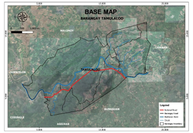
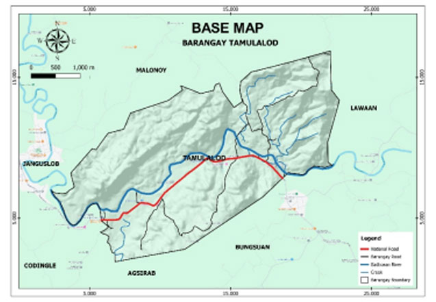
Geo- physical Hazards
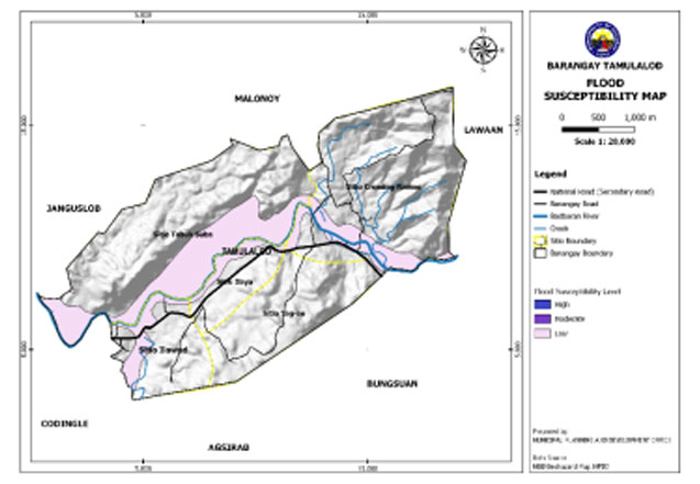
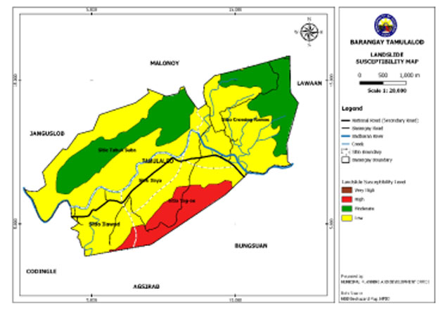
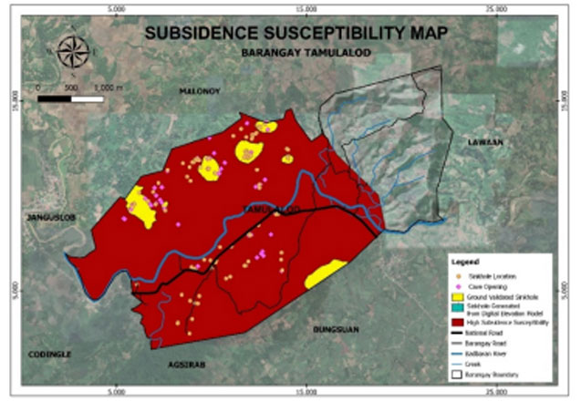
Tamulalod is exposed to 3 types of hazards: rain-induced flooding with low susceptibility levels, rain-induced landslides with 3 susceptibility levels: high, moderate, and low, and KARST Subsidence.
Susceptible to low-level flooding is 232 hectares or 14.97% of the total barangay land area.
An area of 121.81 hectares or 7.86% of the total barangay land area has a high susceptibility level for rain-induced landslide. Moderately susceptible have an area of 328.87 hectares or 21.22%, while 1,098.82 hectares or 70.91% have low-level susceptibility.
A portion of the barangay is susceptible to high subsidence having an area of 993.84 hectares or 64.14% of the total barangay land area.
Demographics
Household
The household population of Tamulalod in the 2020 Census was 844 broken down into 236 households or an average of 3.58 members per household.
Population by age group
According to the 2020 Census, the age group with the highest population in Tamulalod is 15 to 19, with 93 individuals. Furthermore, the age group with the lowest population is 75 to 79, with 12 individuals.
Combining age groups, those aged 14 and below, consisting of the young dependent population which includes infants/babies, children, and young adolescents/teenagers, make up an aggregate of 26.90% (227). Those aged 15 up to 64, the economically active population and actual or potential workforce members, constitute a total of 64.57% (545). Finally, the old dependent population consists of senior citizens, those aged 65 and over, a total of 8.53% (72).
Historical population
The population of Tamulalod grew from 533 in 1990 to 844 in 2020, an increase of 311 people over the course of 30 years. The latest census figures in 2020 denote a positive growth rate of 0.53%, or an increase of 21 people, from the previous population of 823 in 2015.
Adjacent barangays
Tamulalod shares a common border with the following barangay(s):
- Lawaan, Dumarao, Capiz
- Codingle, Dumarao, Capiz
- Janguslob, Dumarao, Capiz
- Agsirab, Dumarao, Capiz
- Bungsuan, Dumarao, Capiz

